


2.3 Coasts - Hazards and Management
Depositional processes and features & opportunities of a coastline
Specification
| 2.3 Coasts | |
| Candidates should be able to:Demonstrate an understanding of the work of the sea and wind in eroding, transporting and depositing Describe and explain the formation of the landforms associated with these processes Describe coral reefs and mangrove swamps and the conditions required for their development Demonstrate an understanding that coasts present hazards and offer opportunities for people Explain what can be done to manage the impacts of coastal erosion | Further GuidanceCliffs, wave-cut platforms, caves, arches, stacks, stumps, bay and headland coastlines, beaches, spits, and coastal sand dunes Hazards (including coastal erosion and tropical storms) |
| Case Study required for 2.3The opportunities presented by an area or areas of coastline, the associated hazards and their management | |
Depositional processes
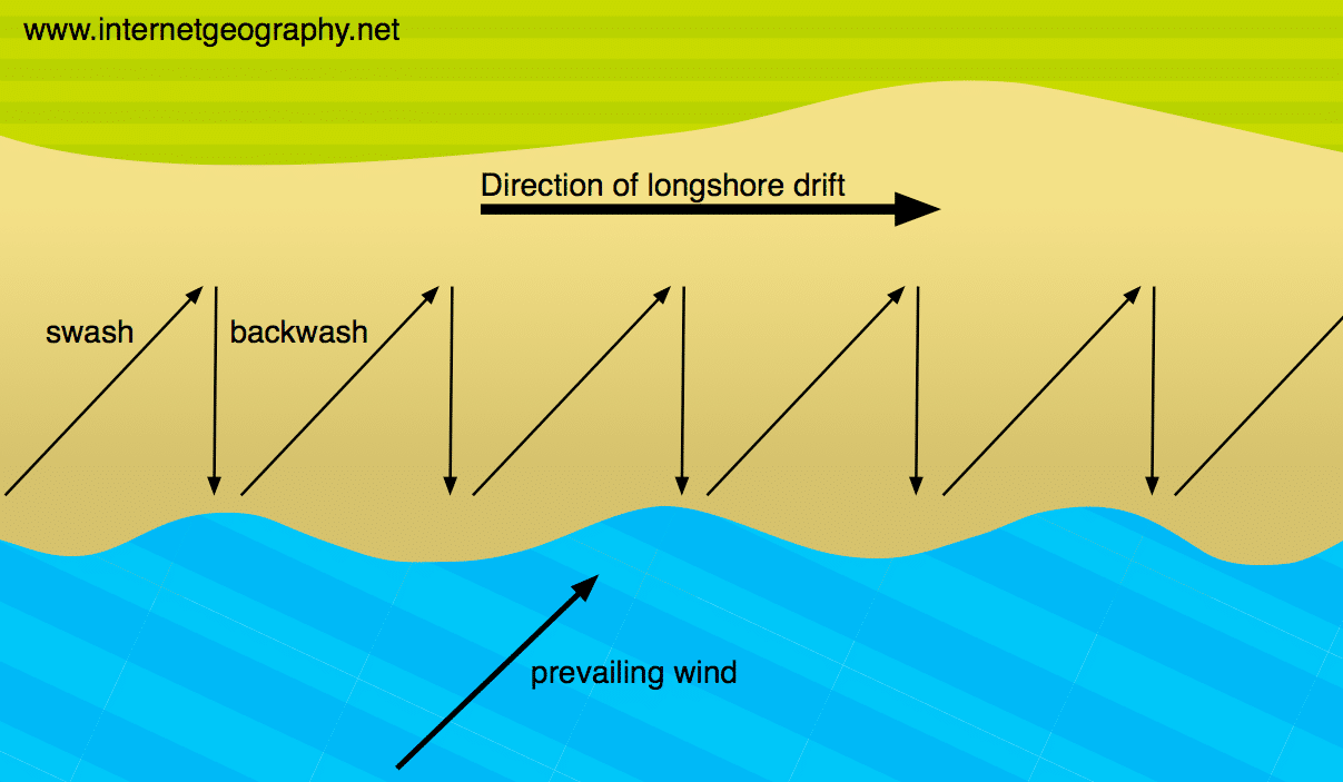
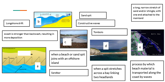
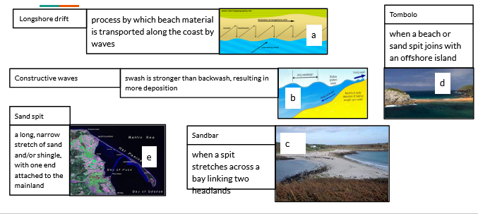
Longshore drift – process by which beach material is transported along the coast by waves.
- Waves approach beach at an angle controlled by prevailing winds
- Material is moved up the beach at an angle in the swash
- Material is carried directly down the beach in the backwash under gravity
- The process repeats, moving material along the beach
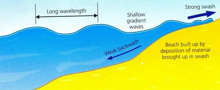
Constructive waves – swash is stronger than backwash, resulting in more deposition
Depositional features
- Sand spit – a long, narrow stretch of sand and/or shingle, with one end attached to the mainland e.g Hel spit, Poland
- Sandbar – develops when a spit stretches across a bay linking two headlands. Behind the sandbar an area of water may be cut off from the sea to create a lagoon.
- Tombolo – forms when a beach or sand spit joins with an offshore island
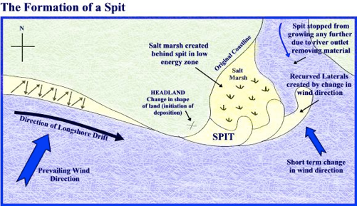
Formation of a sand spit
- Prevailing winds approach the coast at an angle
- Swash comes in at an angle, backwash is vertical
- Material is transported in zig-zag manner – longshore drift
- Sediment transported along the coast
- Spit develops when there is a change in the coastline
- Secondary winds result in hook formation
Case study – Mauritius
- 322 km long coastline
- Surrounded by fringing coral reefs
- Coastal zones and lagoons are used mainly for:
- Fishing – a source of income for locals, can be exported
- Leisure activities such as water skiing, diving, and sailing
- Tourism:
- There was a growth from 27,650 arrivals in 1970 to over 950,000 in 2013 -> One of the key reasons for Mauritius’ economic growth
- Mauritius also grew economically due to:
- The establishment of industries and financial services
- A large increase in sugar export earnings
7-mark question example: ‘For a named area of coast you have studied, outline the opportunities (+the associated hazards and their management)
Still got a question? Leave a comment
Leave a comment